Have you used the Sanborn Fire Insurance Maps while researching your house history? During 19th and early 20th centuries, fire insurance maps were periodically drawn up for cities and towns in the United States. These maps were commissioned by insurance companies in order to more accurately calculate fire risk. They depicted the layout of the town and the location of existing buildings, and were updated periodically. The maps offer a great deal of information, and can show the outline of each building, the building material, the number of stories, doors, windows and chimneys, the address and lot lines, street widths, water pipes, hydrants, and cisterns. The Sanborn Company was the largest, but not the only, fire insurance mapping company. The Sanborn Company was founded in 1867, and created fire insurance maps from 1867 until 1969.
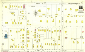
Sanborn Map 1917
The Library of Congress (LOC) has over 6,000 sheets from 28 states available on their website, which can be found here. If your state is not on the LOC site, check with your local library as well as local and state historical societies to see if they have the maps within their collections.
A Youtube video on using the Sanborn maps has been posted by Digging Cincinnati History. Entitled “How to – Use the Sanborn Fire Insurance Maps”, the video offers great tips on what you can find on these maps. While it is discussing Cincinnati and the maps available at the public library there, the suggestions about how to use the maps and what to look for are pertinent no matter where you live.
If you can find your house on one of these maps, you can really get a sense of the buildings on the property, their construction, and the surrounding neighborhood.